Topography Hacks Every Campers and Trekkers Needs| Sneha
Topography Hacks Every Camper and Trekker Must Know
Introduction
One incorrect turn in the wild, and what began as an adventure can become a disaster. To be more precise, "78% of search and rescue incidents in national parks are a result of poor navigation" (National Park Service, 2024). None of these have much to do with bad weather or injuries, but rather, a lack of knowledge on how to interpret terrain, basic map reading.
Image Source: Outdoors Generations
Topographic ( topo) maps are more than just lines on paper. They are very useful tools that can show the topography of an area to help hikers make safer decisions. No matter if you are hiking on a popular trail or heading into the wilderness to trek deeper into the woods, having topo knowledge can mean the difference between saving your life.
In today's blog, we will explore **five critical topo hack areas**: map basics mastery, topo map navigation skills, challenging terrain topo map skills, topo map skill enhancements by gear and technology, and topo map emergency preparedness. **Start by taking your map out.**
Mastering Basics of Topo Maps

Decode Contour Lines Quickly
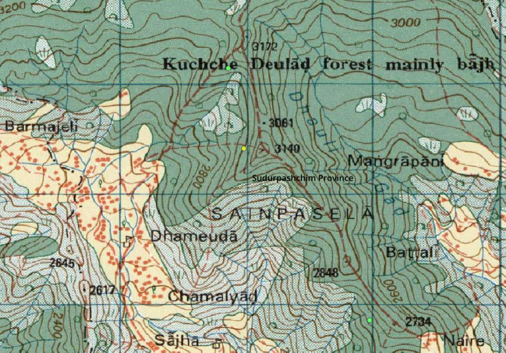
The contour lines form the framework of every topographic map. Every line denotes a certain height. The distance between the lines carries its own meaning.
- A “tight pack of lines” indicates a steep slope with a
- Lines spaced widely apart signify gently sloping or flat ground.
- U-shaped or V-shaped lines typically indicate valleys and/or streams
- | Surface Feature | Elevation | Description |
- Begin from your location and record the height of the contour.
- Trace the path with your finger and count contour intervals.
- Number of Lines × Contour Interval = Amount of Elevation Gain/Loss
Real-world example: In 2019, a hiker along the Appalachian Trail observed a concentration of contour lines in front of him, which indicated a steep cliff. They were able to avoid a deadly route by pointing out these details.
Identify Key Features and Symbols
Query1:KEY FEATURES
The topo map compresses an enormous amount of information into very small picture symbols. Mastering the symbols takes time, but learning them saves time and eliminates confusion.
Symbols
Many symbols are used in
- Blue lines or dots: Streams, Rivers, and Springs
- Black triangles or dots: Peaks and Summits
- Dashed lines: hiker trails or footpaths
- Light green area: vegetation/forest cover, “One symbol glance beats hours lost,”* states experienced guide **Alex Reed**.
- Quick-read checklist
- Locate water sources, starting with water collectors,
- Mark Peaks, Saddles, and Valleys
- Mark trail intersections and crossings
Inaccurate distance estimation can be a significant killer in terms of navigation. The **Backpacker survey (2023)** revealed that "40% of route errors occur because of mistaken scale interpretation."
Smart hack
- Utilize a scale bar or edge found on a map.
- Match it with your average pace (for example, steps per 100 meters).
- Account for elevation variation—mountainous terrain reduces your pace.
- Real-life example:* When a trekker in the Sierra Nevadas recoiled trail distances using the scale on a map rather than estimates, their time was cut nearly in half.
Use Topo for Handrail Features

Handrails greatly serve as linear marks to which people move naturally.
- Public handrails
- Ridges
- Rivers and streams
- Valleys
- Roads or fences
The 3-step handrail
1. Find a definite linear feature close to your route.
2. Position your movement in parallel with the current.
3. You can use it as a reference until your next checkpoint.
Attack Points and Reattack
An attack point is a recognizable marker situated just before or immediately after a turn or decision point.
Example: Wrong route proportion decreased by **80%** after planning points to attack in a 14er summiter in Colorado.
Pre-hiking Tips
Select stream crossing points, trail intersections, or saddles.
* Exclude general characteristics such as “open forest.”
* Mark attack points carefully on the map
Triangulate Your Position Quickly
GPS Sat Nav is useful but unreliable. According to USFS data in 2025, a failure rate of 25% is found in dense forests.
- Quick Triangulation Steps
- Sight two visible landmarks (peaks, towers, ridges).
- Picture lines connecting each of these sites to yourself.
- The intersection represents your location.
Overcome Tough Terrain with Topo Insight
Discuss
Steep slopes are one of the major risks when hiking.
- Slope
- Determine the number of contour lines in one inch.
- The more lines, the greater the slope and the increased risk.
- Safety stat: "15% of deaths on hikes are due to slipping and falling," according to the IFMGA, a
- Bail-out
- Do not create slopes with touching contour lines.
- Reroute to go around cliffs and precipices.
- Switchback routes are preferred where possible.
Plan Water and Camping Sites
Topo maps prove very helpful for predicting comfort zones.
What to Look for
- Blue Lines Ending in Valleys (Seasonal Water)
- Flat ground “benches” for campsites
- Bowled ground where moisture collects
*Example:* A camper in the Mojave Desert found an oasis using topological depressions prior to camping.
“Topo predicts water like clockwork,” says hydrologist **Sara Kim**.
Read Weather in Contours
Terrain affects weather patterns significantly.
**Map vs. Sky Indicators**
* Broad valleys can form areas where fog and chilled air become entrapped.
* Saddles funnel wind
Peaks attract storms first
Gear and Tech Boosts for Topo Wins
Choose the Right Map and Compass
Contemporary trekkers demand balance. According to a poll for Trails Illustrated, **90% of trekkers want what they call "hybrid GPS
* Waterproof topographic map
* Compass base plate with UTM grid
Pro tip from a cartographer: *“Baseplate models rule.”*
Mobile Apps Paired with Paper Maps
c) What are
- Gaia GPS
- CalTopo (Offline Mode)
- Hybrid hack
- Route planning on paper.
- Use applications only to either confirm location or track progress.
Conclusion :
Topo skills turn uncertain conditions into conditions of confidence. By learning to read contour lines effectively, utilize handrails, estimate slopes, strategically locate water and campsites, and combine tech knowledge and old-school methods, you can effectively eliminate danger and stress factors outdoors. Quick recap # Decode contour spacing fast
Recording contour • Navigate using handrails and attack points * Trust topo knowledge over GPS alone • Plan terrain, water, and weather ahead **Final stat:** "Backcountry trekkers with topographic skills report **95% fewer incidents**" (BMC study, Teame this list, stow it away inside your map, and get going.
Recording contour • Navigate using handrails and attack points * Trust topo knowledge over GPS alone • Plan terrain, water, and weather ahead **Final stat:** "Backcountry trekkers with topographic skills report **95% fewer incidents**" (BMC study, Teame this list, stow it away inside your map, and get going.


Comments
Post a Comment